This evening I wanted to take some time to discuss the tornadoes in our viewing area and what made this situation challenging for meteorologists at the National Weather Service and on television.
As you probably know by now, the tornado in Mahoning County was not preceded by a Tornado Warning from the National Weather Service. Many have been upset by this and that in understandable. Particularly if your property was damaged. While ideally every tornado is warned for ahead of time, the science is just not there yet. In fact, in the United States, about 70% of all confirmed tornadoes occur in an active tornado-warned area. That means that 3 out of every 10 occur where there is no official warning. This success rate is about DOUBLE what it was 30 years ago, but of course, still not good enough.
Many tornadoes that are not warned are ones like we had near Canfield. They drop quickly and then lift quickly…leaving behind little evidence on Doppler Radar that a tornado is occurring. We rely heavily on Doppler Radar to detect tornadoes. It DOES have limitations through.
Canfield is roughly 66 miles as the crow flies from the National Weather Service radar, which is located southwest of Cleveland. 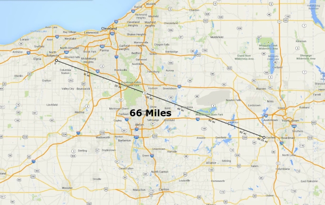 Because of the curvature of the Earth, the height of the radar beam increases with distance away from the radar site.
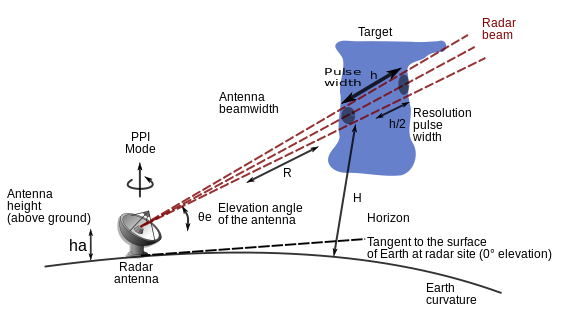
By the time the beam is over Canfield, it is about 5,000 feet in the air. This can make rotation in the lowest levels of the atmosphere hard to detect. Here is the wind velocity image from right about the time the tornado touched down (2:12pm): 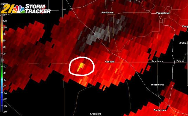 Notice, there is a “spike” in the wind velocity data being detected at exactly the spot the tornado touched down. BUT, no rotation is detected. We would have seen some greenish colors near that location had rotation been detected. Compare that image to the tornado in Mercer County:
 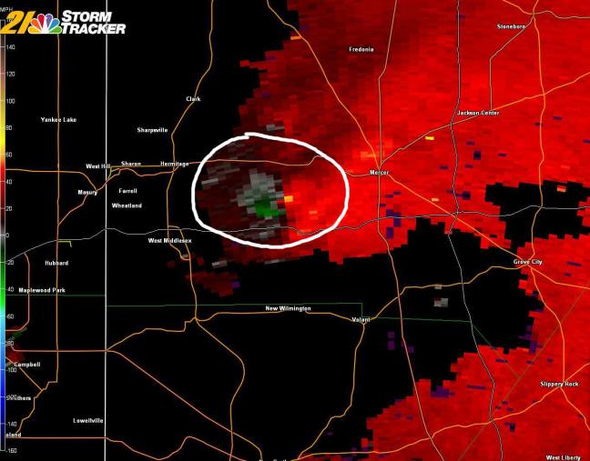 A NICE “couplet” of green (wind blowing toward the radar) and red/yellow (wind blowing away from the radar). Clear rotation and an easy Tornado Warning for the NWS (in Pittsburgh) to issue.
Despite the lack of a rotation “signature” on the Canfield tornado, at 2:12pm, there was an interesting signature on the “regular” radar. A hook shape was evident for only ONE scan: 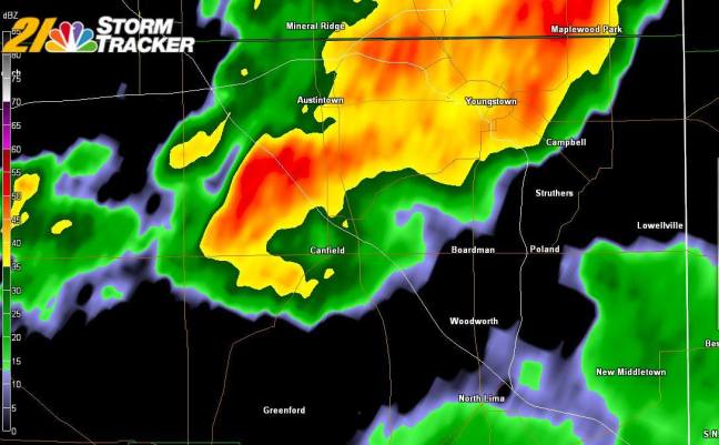 This caught my attention during our online streaming coverage, but with no clear rotation in the velocity data I did not immediately declare that this was likely a tornado and people should seek shelter. In hindsight I probably should have played it up more, but this was a tough call to make on the fly.
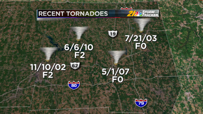
I thought it may be interesting to take a look at the recent history of tornadoes in Mahoning and Mercer counties. I showed these graphics on the air this evening showing the most recent twisters in the counties: 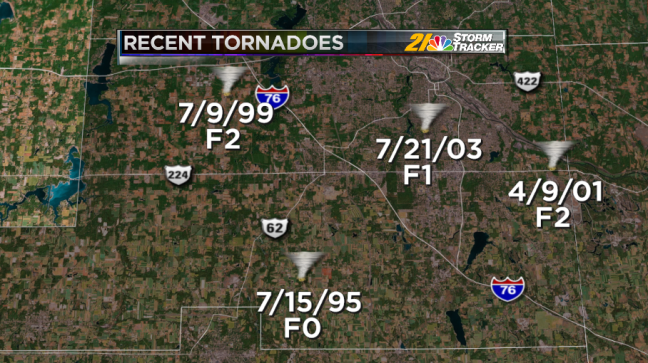
A more thorough list of tornadoes, going back to 1950. These tables include the location, the damage caused, the rating on the Fujita scale, among other things.
Mahoning:  Mercer:
 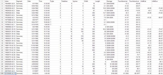 Interesting to note how many more tornadoes there have been in Mercer County. I am not sure why this is, other than it being a larger county.
There have been ZERO F4/F5 tornadoes in Mahoning County since 1950. The strongest on record was an F3 twister shown here: 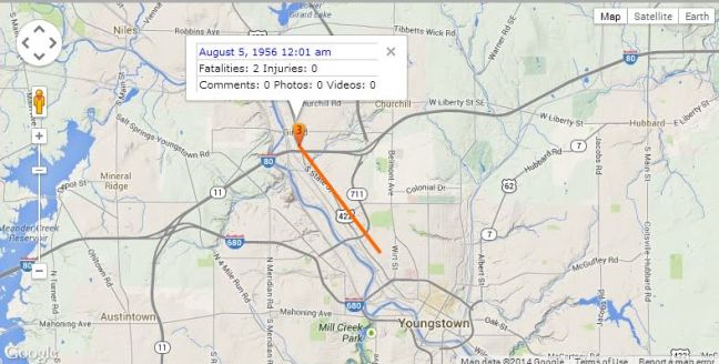 The longest-lived tornado I could find was this one (F2) from 1963 that was on the ground for 15 miles and paralleled Rt 224:
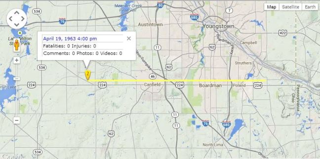
How about a quick look at the FUTURE weather? After a warm weekend, next week is looking quite cool for July, especially during the middle of the week. Check out the upper-air pattern: 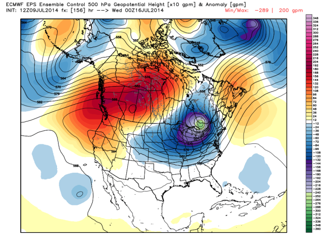 Looks like it did in the Winter! Deep trough over the Great Lakes. That’s actually part of the Polar Vortex! Remember, the Polar Vortex exists year-round (despite the hysteria in the media during the Winter, much of implying this was some sort of new thing). This will result in a big area of below-average temperatures:
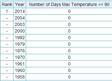
 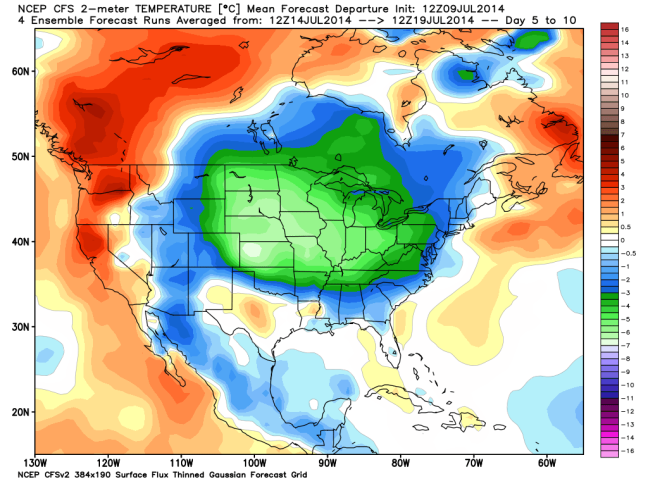 Since it is July and not January, that means temperatures will not be “cold” but we will see at least a few days with highs closer to 70 than 80. 90 is certainly out of the question. We have not had a 90 degree reading yet this year. How unusual is that? Not all that unusual. Here’s a list of years with ZERO 90 degree days for the entire year.
Here’s the list of Julys with no 90+ days; 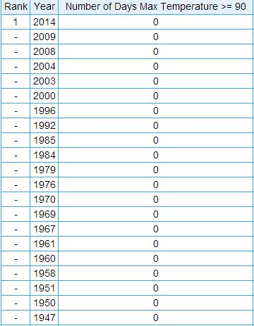
Thanks for reading!
Eric
